For property developers, REITs, and large-scale investors operating in Johannesburg, the regulatory landscape has shifted beneath our feet. The era of relying solely on rigid, historical Town Planning Schemes is over. The new reality is driven by the Spatial Development Framework (SDF 2040) and operationalized through the Nodal Review. If you are currently assessing land acquisitions or looking to unlock value in an existing portfolio, misinterpreting the Nodal Review is not just a compliance risk—it is a direct threat to your return on investment.
At Glensburg, we frequently encounter sophisticated clients who are frustrated by the ambiguity. They see the “For Sale” sign, but they cannot definitively determine the site’s yield potential under the new regime. The core question is no longer just “What is the zoning?” but “Where does this site sit within the city’s strategic densification hierarchy?”
Quick Definition: What is the Nodal Review
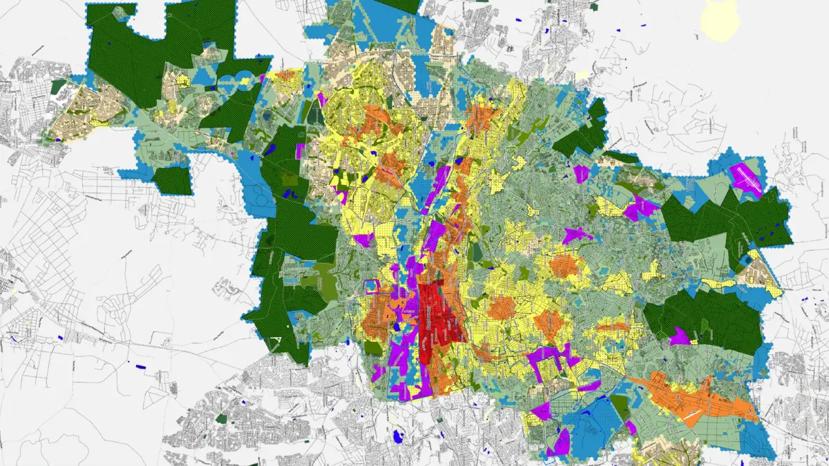
The Johannesburg Nodal Review is the city’s strategic policy mechanism that directs where high-density development should occur. It replaces the old, sprawling approach of Town Planning Schemes with focused “nodes” and “corridors.” It prioritizes Floor Area Ratio (FAR) over traditional “units per hectare” limits, allowing for significantly higher vertical bulk in designated areas like Rosebank, Sandton, and the CBD.
1. The “Zones of Opportunity”: Decoding the Density Hierarchy
The Nodal Review does not apply a blanket density across the city. It uses a nuanced, tiered approach to define where verticality is encouraged versus where “gentle density” is preferred. Understanding these distinctions is critical for site selection.
a). The General Urban Zone (High-Intensity)
This is the sweet spot for high-ticket developers looking for maximum yield. The General Urban Zone covers the city’s primary metropolitan nodes and major transit arteries. In these zones, the policy intent is explicitly high-rise, mixed-use development.
- The Development Play: Large-scale residential towers, significant mixed-use precincts, and high-density office conversions.
- The Glensburg Insight: In General Urban Zones, we often find that height restrictions are less of an issue than bulk (FAR) and parking requirements. The city is willing to trade height for proximity to transit.
b). Suburban Densification Zones (The Missing Middle)
This is where many investors get tripped up. Suburban Densification areas are not designated for 20-storey towers. These zones are intended to bridge the gap between traditional single-family suburbs and high-intensity nodes.
- The Development Play: Townhouse complexes, 3-4 storey walk-up apartments, and subdivision for cluster developments.
- The Glensburg Insight: Success here relies on efficient design. The margins are tighter than high-rise, so understanding the specific sub-zoning is crucial to ensure project feasibility.
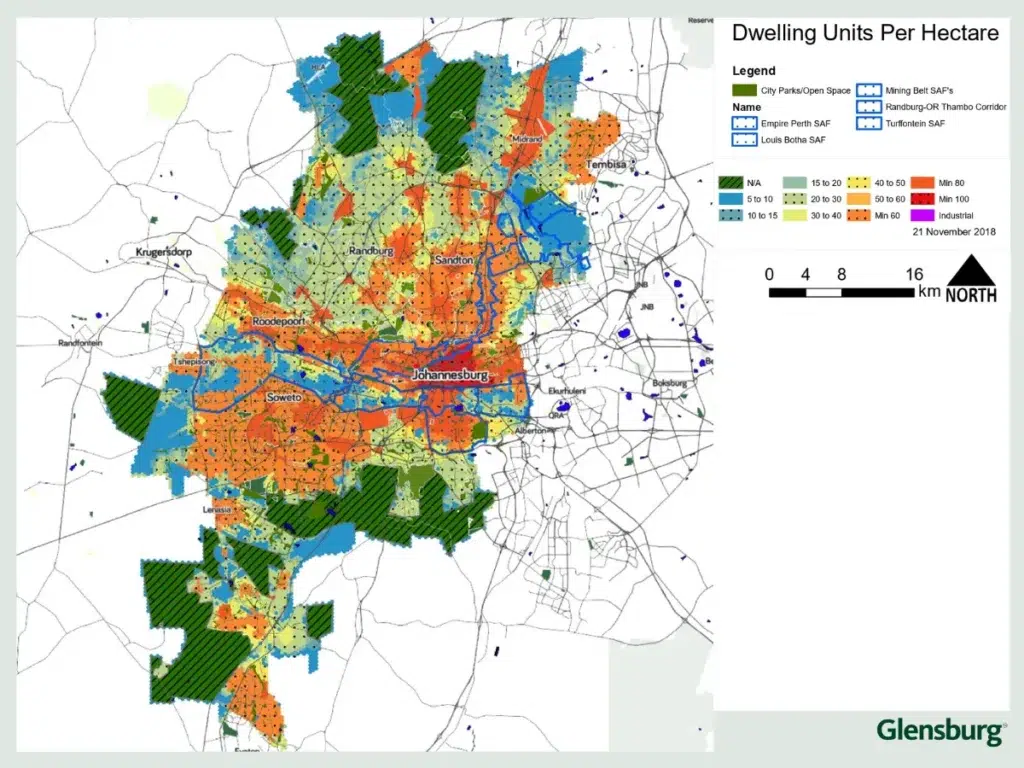
2. The New Metrics: Why “Units Per Hectare” is Obsolete
Perhaps the most significant technical shift for developer’s feasibility studies is the move away from “density” defined strictly by units per hectare, toward Floor Area Ratio (FAR) and Height Zones.
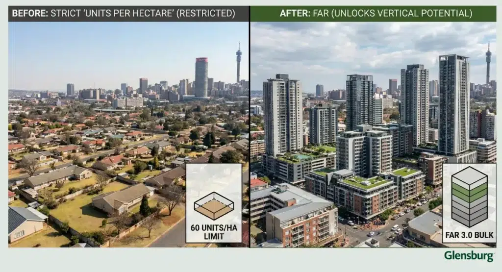
a). The Dominance of FAR (Floor Area Ratio)
FAR (or FSR) controls the total square meterage you can build relative to the land size. If a 2,000m² site has an FAR of 3.0, you can build 6,000m² of bulk floor area. Why this matters for ROI: This flexibility allows developers to respond better to market trends without needing a full Rezoning Application just to change the unit mix.
b). Height is Now a Separate Control
Previously, height was often tied intrinsically to density. Now, height is often governed by separate “Height Zones” overlaid on the Nodal areas. At Glensburg, we model both constraints simultaneously to determine the actual achievable envelope.
3. The “Corridors of Freedom”: Transit-Oriented Development (TOD) Bonuses
The city’s policy is unambiguous: if you build within walking distance (typically 500m to 800m) of a BRT (Rea Vaya) station or a Gautrain station, you are entitled to significantly higher density rights. For REITs looking for long-term asset appreciation, securing sites within these defined TOD catchments is a primary strategy. The infrastructure is already there, and the policy wind is at your back.
4. The Hidden Hurdles: It’s Not Just About the Map
We would be doing a disservice if we pretended that a favorable Nodal Review designation guarantees a shovel in the ground. Experienced developers know that policy intent frequently clashes with on-the-ground reality.
a). Infrastructure Capacity (The “Wet Services” Bottleneck)
A site may be zoned for a 200-unit tower, but does Johannesburg Water have the bulk sewer capacity to handle it? We frequently see projects delayed because the developer failed to account for substantial engineering service contributions.
b). The Inclusionary Housing Policy Framework
In Johannesburg, if your residential development exceeds 20 dwelling units, you trigger the Inclusionary Housing Policy. This generally requires that 30% of the total units be designated for specific lower-income brackets. The Bottom Line: Failing to account for this 30% inclusionary requirement can compress development margins by 12-18% if not factored into the initial land purchase price. A high-density site is fantastic, but your feasibility study must reflect this reality.
5. Glensburg’s Approach: Mapping Your Feasibility Against Reality
The Johannesburg Nodal Review is a powerful tool, but it is complex. Trying to interpret its implications for a specific high-value acquisition using only public domain maps is a risk. At Glensburg, we bridge the gap between high-level municipal policy and site-specific investment reality. We provide a comprehensive feasibility roadmap that outlines:
- The maximum achievable FAR and Height under the current Nodal Review.
- The implications of Inclusionary Housing on your unit mix and bottom line.
- The likely infrastructure constraints and contribution costs.
- A realistic timeline for Rezoning Approval based on the site’s alignment with city strategy.
Disclaimer
Because every property has unique zoning constraints and municipal bylaws are subject to change, this article serves as a general guide rather than site-specific counsel. See our Editorial Policy